Builder-informed preliminary land reports that simplify flood, elevation, soil, and zoning data into easy-to-understand insights before you make a costly decision.
explore REPORTsDesigned to help buyers better understand what may impact usability, development potential, and long-term property costs.
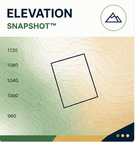
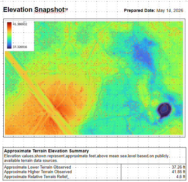
Understand the terrain, slope, and elevation patterns that may impact future property use.
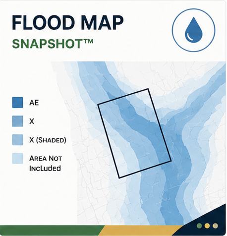
Quickly identify FEMA flood zones and identify potential flood-risk areas on the property.
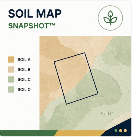
Review mapped soil conditions and general drainage characteristics for the site.
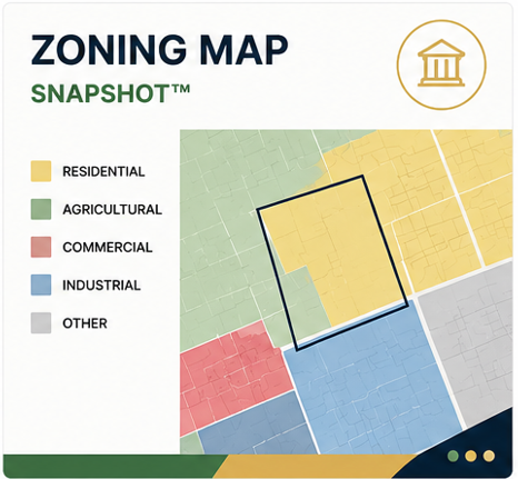
Review current zoning, future land use, and general property use information.
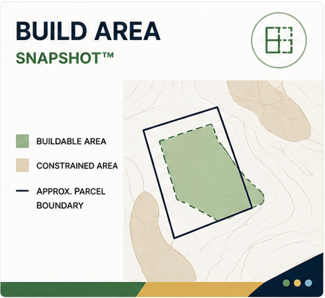
Identify potentially more usable areas of the property based on observable site conditions.

Dirt Data reports are designed to help buyers better understand potential land and property constraints before investing significant time, money, or development planning into a property. By combining publicly available mapping data with practical builder-informed interpretation, the goal is to simplify early-stage property research into clear, visual, easy-to-understand reports.
Understand Before You Buy
Simplified land information before making a costly decision.
Builder-Informed Perspective
Reports shaped by real-world building and site experience.
Easy To Read
Clear visual reports without digging through multiple county websites and GIS websites.
Preview the layout, structure, and visual formatting used throughout Dirt Data snapshot reports.
VIEW SAMPLE REPORT